Wednesday
|
|
Wednesday
|
|
Wednesday 5th November 2014
|
Castleward
On a spectacularly sunny and settled November morning, Castle Ward house and estate were looking their best as we arrived to take part in Peter White’s walk on November 5. We gathered in the car park and set off at around 10.45am past the courtyard, down through a pedestrian tunnel and across fields which were still somewhat waterlogged after the heavy rain of the day before. A brief halt was called to admire the swans and ducks on the ornamental lake before we proceeded down to Audley’s Castle and the shoreline of Strangford Lough. The water was calm and blue, the sky was cloudless and the sun was warm. Across the water we could see Portaferry with its orderly waterfront houses. Although it was high tide a seal was spotted close to the shore, bobbing its head up out of the water, and a small flock of oystercatchers had gathered at the water’s edge. |
Some in the party took so long to absorb the grandeur of this scene that we lost track of our leader and his main group. Happily, a few mobile phone calls re-united us and we were back on track, heading round to the caravan site. The new kids on the block were wooden pods set back from the shore but with lovely views across the water. They had been cleared for the winter but happily the National Trust had left two plastic seats on the balcony of each pod, so we were able to use these seats plus a picnic table for a short coffee stop.
From the Shore Trail we progressed to the Boundary Trail (an impressive 13km if one was to do the entire circuit). Woodland on one side and pasture on the other, and occasional lovely views down over to the lough. We passed the main gate and may even have been on the hoof trail or the bike trail, as there was evidence of both horse-shoes and bicycle tyre treads. Happily horses go clockwise while bikes go anti- |
clockwise, which must suit both parties. We met just one bicycle on our walk, but pondered that it would make rather a nice cycle outing at some future occasion.
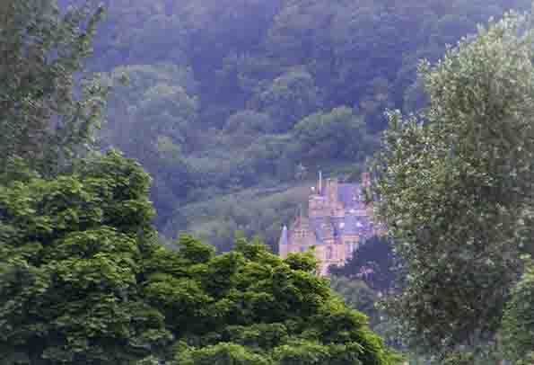
As we neared our destination, the Coach House Tea Room, we caught some magnificent glimpses of the big house, glistening in the sun. Soon the courtyard hove into sight and we were spot on schedule at 1pm. Pleased to see that the plastic furniture in the cafe has been replaced by some more appropriate wooden tables and chairs. All nine of us stayed for a bite of lunch and our appetites were well satisfied as we sat back and reflected on our good fortune to be out in the fresh air on such a beautiful day. Thanks to Peter for organising. Robin Morton |
Wednesday 29th October 2014
|
Six Spartans gathered punctually at 10.30am at Carrickfergus Railway Station, the rendezvous point identified by leader David Flinn. From there we travelled up to Woodburn Forest in two cars. The walk took us along forest tracks and some quiet roads, then past the highest of Woodburn's three reservoirs to the road up to Knockagh Monument, high above
|
Greenisland. On a beautifully sunny and mild morning, what a pleasant contrast to the rain of the previous day, we savoured the panoramic view over Belfast Lough and beyond to the distant land mass of the Lake District. Thankfully Rachel had sufficient multi-grain bars to distribute to all participants, so no-one expired from hunger. Back at the cars by
|
1.50pm and thence to the Courtyard in Carrickfergus for lunch. David enjoyed his lemon drizzle cake, but don't tell anyone!
Thanks to David for organising, he picked the best weather of the week! Robin Morton |
Wednesday 22nd October 2014
|
Castlewellan Loanins
Bus 17a looped around the Upper Square at Castlewellan at 1101 and whilst I thought initially that Peter White was about to alight, it turned out to be his double without a rucsack. For a moment it looked like no-one had turned up but then 4 other Spartans appeared out of cars to rendezvous in the blustery rain. Fully waterproofed and hoods up we headed out along the back streets of Castlewellan to brave the elements and face a pretty poor forecast. However it was fortuitous that we had delayed the start of the walk to coordinate with the bus time table as even before we had left the town, hoods were down temporarily. At least that is what we expected but from then on the remainder of the walk was dry, the threated pulse of heavy rain forecast for 1300 not appearing at all. The walk looped around Bunkers Hill via Dundrinne Road turning right into the first of our loanins that would take us to the end of Drumee Road. From there we connected with two other loanins to connect with the B180 near Maghera. A short section on the road past St |
Joseph’s Primary School led us to another loanin which took us to Church Road. Turning right on Church Road we crossed the busy A50 Castlewellan-Newcastle Road onto Tollymore Road with then a right turn into the delightfully names Wild Forest Lane. Turning left along Wild Forest Lane onto another loanin took us directly to the front Barbican Gate of Tollymore. We had therefore reached Tollymore with only around 20% of the walk on a road.
A walk along the cedar avenue, which we have all driven along many times no doubt but rarely walked, was enjoyed. A short cut through the camp site, which did have several caravaners in residence, took us to the Clanbrassil Barn where we stopped for a cuppa at one of the picnic tables, which had nicely dried out. We then set off towards the Bryansford Gate where we were accosted, rather politely, my Damien a market researcher. The short interview concerning our rather brief visit to Tollymore actually delayed us for well over 10 minutes. I do hope that all the answers were truthful as I declared that all members of the party were under 65. |
Opposite Bryansford Post Office we took The Village Lane stopping briefly to observe the delightful properties with well-manicured gardens. At the top of the lane another tree covered loanin took us to Burrenragh Road. Climbing up McCleans Hill the expanse of Castlewellan came into view. Parents were waiting for the new P1 class to emerge from St Patrick’s Primary which we passed before descending Green Lane to Burrenbridge Road, from where we took the marked route across fields and two bridges to the stile at Cow Lane. Ironically it was only metres from the stile where I got my feet wet in the waterlogged field.
Cow Lane led directly into the lower end of Castlewellan, where Urban proved an excellent late lunch stop with a good choice of fare and friendly staff. Over lunch the GPS was declared to have recorded 9.1miles and we all hoped that the rain had continued in Belfast so that those who had opted not to come on the walk would not feel too disappointed! Stephen Gilmore |
Wednesday
|
|
Wednesday
|
|
Wednesday 13th AugustRedburn Country Park
Having gathered at Rory’s Glen car park on the Old Holywood Road, the 18 Spartans attending set off up the narrow steep path into Redburn Country Park. The park is the old estate of the Dunville family whose main business in the 19th & early 20th century was whiskey distilling. After a 25 minute climb through beech forest alongside small streams & open meadow we reached the highest part of the park with clear views down into the city, the port & across the lough. The bright & clear weather made the tramp up the hill worthwhile. Having had a short rest we continued on following the perimeter of the park down into the heart of the beech forest - past Holywood Golf Club (home club of Rory McIlroy) & on to another stop at the bear pit made for the Dunville’s pet bear Bruno. After a short while |
|
Wednesday 30th July 2014Belfast Hills Navigation
4 of us went to Belfast Castle to try an orienteering evening as a team, we went for the longer course and swiftly found that a lot of micro navigation through briars was required. We survived but next time we will stick to the shorter course. An interesting enough ramble through the forest grounds- thanks to Lagan orienteers for organising. |
Wednesday 23rd July 2014Cregagh Glen
After a lull in proceedings over the holiday period, the programme of Wednesday evening Spartan Red Sox walks resumed on Wednesday July 23. Our destination was Cregagh Glen, and some 16 Red Sox materialised for the walk. On what was the warmest day of the year so far, it was a relief to cross the Knock dual-carriageway and reach the shade of the trees in the glen. Thousands of motorists must pass the entrance to Cregagh Glen every day without realising what lies behind the gap in the hedge. The entrance is virtually unmarked, and as Reg Magowan remarked, it is a hidden gem. The glen is so close to suburbia, but as we began our ascent through the woodland, the traffic noise subsided and there was silence – apart from the energetic chatter of the Red Sox members! Not a breath of wind in the trees but occasional dramatic shafts of sunlight. Unfortunately the fabled waterfall was more of a trickle than a torrent, a reflection of the recent spell of exceptionally dry weather. But we could still admire the “moist ferns and mosses deep” referred to in the poem by Nesca Robb of the Robb family which used to own the land. Cregagh Glen is still a place apart, so easily accessible but little known, and not heavily used by walkers. During our walk we met occasional dog owners, a few groups of people out for an evening stroll and even a jogger heading up at some speed. We took our time on a warm evening, pausing regularly to admire the greenery, the stream and to take a swig of water. Once the work on the Connswater path is completed, the plan is to link in with Cregagh Glen, which will provide a green artery from the top of the glen right down to the Lagan towpath. |
|
Friday 20th June 2014Howth Head
Six of us embarked on the on the Enterprise en route to Dublin where we transfered to the Dart to take us to Howth station where we were delighted to meet Mary who had torn herself away from a flower show at RDS to join us. The walk is described as a bracing stroll around the coastal promontary of Howth Head with its dazzling 360 degree views over the city,and the hills and coastline for 50 km around.,and it did not disappoint.The weather was perfect with beautifully clear blue skies.We left the quayside at Howth and climbed up to the ruins of St Marys Abbey where there was spectacular view of Howth Marina and the islands beyond.Continuing we climbed up through grassy paths and trees to reach Howth golf course where there was a spectacular view northwards and we could clearly see the Mournes. We managed to navigate ourselves through the thick heather down to the sea and the cliff walk and the views southwards over Dublin, Killiney,Bray and to the Wicklow |
|
Wednesday 11th May 2014Belvoir Park
|
|
Wednesday PM
|
|
Wednesday AM
|
Along the way we had time to admire a recently completed five-star self-catering house and to marvel at the promised array of bluebells and primroses. In parts, the dunes were a mass of bluebells, a treat for the eyes.
Marie's knowledge of Murlough must be unrivalled and she confidently led us along paths which most of us had never visited before. Plenty of time to admire the flora and fauna in the dunes before taking to the boardwalk down to the beach. The sea was flat calm and the view towards the magnificent Mournes was jaw-dropping. Although the beach is notoriously stony, families were already establishing their picnic spots for the day. Marie shrewdly led us down to the water where a strip of sand enabled us |
to walk easily along the beach towards Newcastle before we took a sharp right and back via another board walk to the car park. The National Trust describes Murlough National Nature Reserve as a fragile 6000 year old sand dune system which it has owned and managed as Ireland’s first Nature Reserve since 1967.
Certainly, there was worrying evidence of the erosion caused by last winter's storms, but Murlough is still a priceless asset. As ever, the chat was great and the company convivial. The exercise over, most of the party adjourned to the Percy French bistro in Newcastle for a well deserved lunch. Many thanks to Marie for leading the walk. Robin Morton |
Wednesday
|
|
Wednesday
|
knew the area around Slieve Croob like the back of her hand. And as befits a member of the Down Danderers she set off up the brae at a fairly stiff pace.
Our chosen route was along a country road and then right via the Pass Loanen, and thence up the hill following the very useful line of white marker posts. Spring had sprung and on a cloudy but dry day the countryside looked splendid. Plenty of sheep in the fields, but their hopes that we were about to provide fodder were sadly dashed, to much plaintive bleating. Along the way Jean gave us a considerable amount of information about the area and the local community. Slieve Croob, she explained, is regarded as the "mother" of the Mournes as it is a good deal older than Donard etc. it translates as the Mountain of the Hoof and is also known colloquially as the Mountain of the Twelve Cairns. |
The transmitter studded summit of Slieve Croob stands at 534m (1,755 ft) but as we were all so familiar already with the peak, and as the wind was becoming stiffer, and as lunch was beckoning, we made a unanimous decision to stop at the final white marker post, admire the view one more time and then make a speedy descent, back the way we had come.
Many thanks to Marie for organising and to Jean for acting as stand-in leader. We all enjoyed our three-hour walk, got plenty of fresh air and arrived back both dry and feeling well exercised. In a month's time, on April 16 the SRS Wednesday walkers are back in Dromore for a walk Marie is organising. We will be exploring the loanens, so don't miss that. More details shortly. And Marie promises there will be no snow to impede our way this year! Robin Morton |
Wednesday
|
|
Wednesday
|
|


